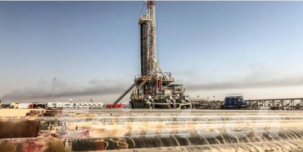
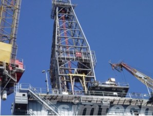
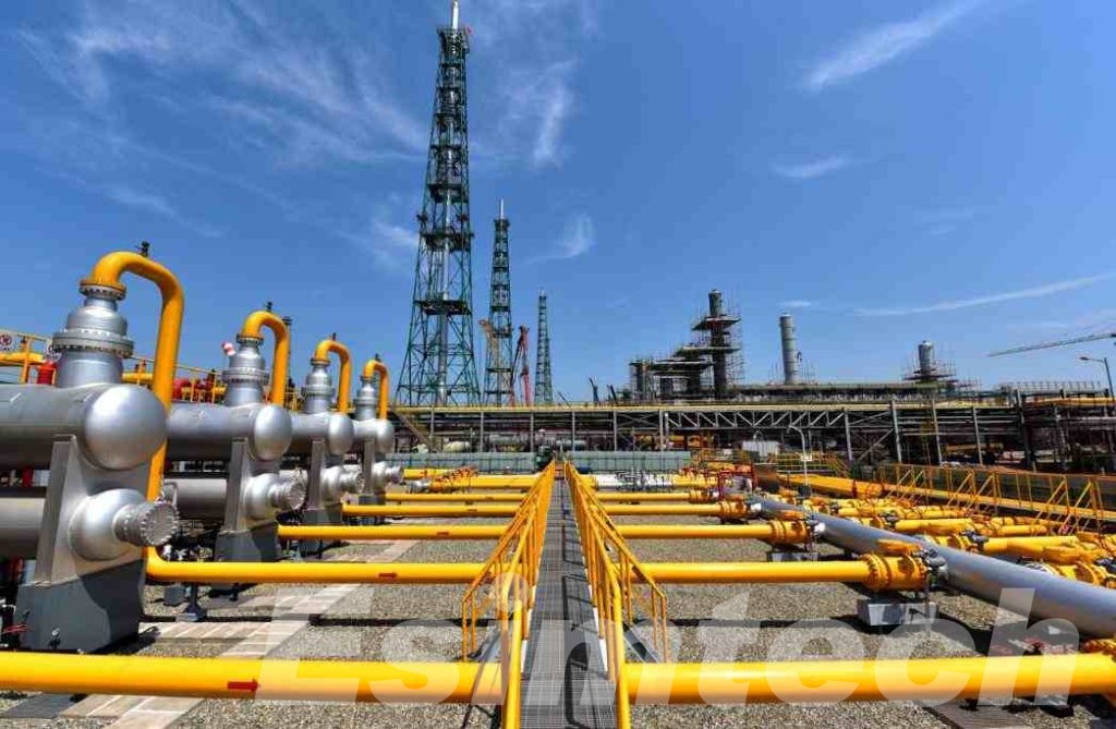
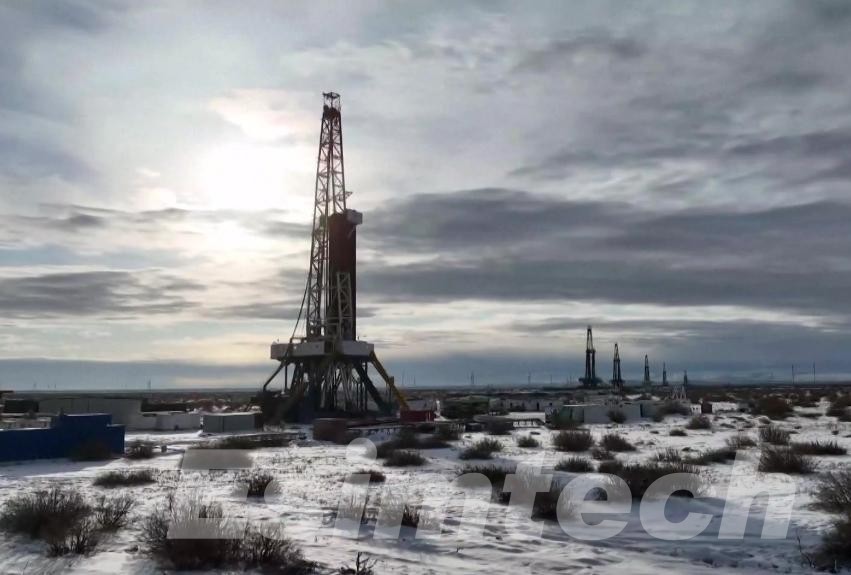
The Transformative Power of Borehole Imaging in the Oil and Gas Industry
Borehole imaging is an indispensable tool in the oil and gas industry, providing high-resolution images of borehole walls to aid in subsurface exploration, formation evaluation, and reservoir characterization. By providing detailed visual data of the borehole walls, this technology enables geologists and engineers to make more informed decisions, leading to increased efficiency and reduced risks in oil and gas operations. In this article, we delve into the significance, techniques, applications of borehole imaging in the oil and gas sector as well as how simulations used in the in the application and advancement of borehole imaging.
The Importance of Borehole Imaging in the Oil and Gas Industry
- Enhanced Formation Evaluation: It provides high-resolution images that help in identifying and evaluating geological formations, essential for locating hydrocarbon deposits.
- Improved Drilling Efficiency: By offering detailed insights into the subsurface environment, borehole imaging helps in optimizing drilling strategies, minimizing the risk of drilling into non-productive zones.
- Comprehensive Reservoir Characterization: It aids in understanding the structure and properties of reservoirs, which is critical for effective resource extraction and management.
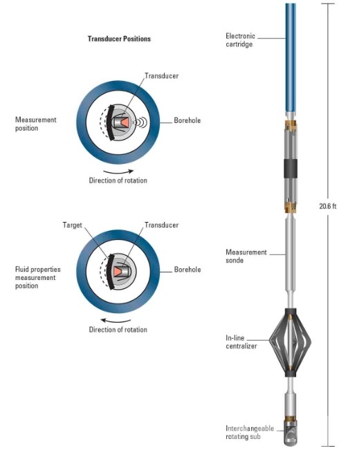
Primary Techniques and Technologies Used in Borehole Imaging
These technologies used in borehole imaging leverage various techniques to obtain detailed visual data, each tailored to specific conditions and requirements.
1. Optical Imaging
Optical Televiewers: Optical imaging tools utilize visible light to capture high-resolution, color images of borehole walls. These tools are particularly effective in clear borehole fluids and are used to discern fine details of rock textures, bedding planes, and structural features. Key benefits include:
- High-Resolution Detail: Provides detailed images that reveal rock texture, sedimentary structures, and small-scale features.
- Color Imaging: Enhances the ability to differentiate between various rock types and minerals based on color variations.
2. Acoustic Imaging
Acoustic Televiewers: Acoustic imaging tools employ sound waves to generate images of the borehole walls. They are versatile and can be used in various borehole conditions, including those filled with drilling mud or other opaque fluids. This makes them highly valuable for:
- Mud-Filled Boreholes: Effective in environments where optical imaging might fail due to opaque fluids.
- Fracture Analysis: Excellent for identifying and characterizing fractures, as well as providing information on their orientation and density.
Shear Wave Imaging: This technique involves the use of shear waves to capture borehole wall images. Shear wave imaging can offer insights into rock mechanical properties and help in identifying lithological variations.
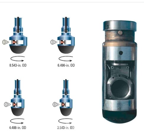
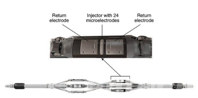
2. Electrical Imaging
Resistivity Tools: Resistivity imaging measures the electrical resistivity of the borehole walls, producing images that highlight variations in rock properties. It is particularly useful for:
- Lithology Differentiation: Helps distinguish between different rock types based on their resistivity.
- Fracture Detection: Effective in identifying fractures and fault zones due to the contrast in resistivity.
Microresistivity Imaging: These tools provide high-resolution resistivity images by using an array of small electrodes. They are capable of detecting very fine features and are commonly used in formation evaluation and fracture analysis.
3. Nuclear Magnetic Resonance (NMR) Imaging
NMR Tools: These advanced tools utilize the principles of nuclear magnetic resonance to capture detailed images of borehole walls. NMR imaging is particularly valuable for:
- Porosity and Permeability: Provides detailed information about the porosity and permeability of rock formations.
- Fluid Characterization: Helps determine the type and quantity of fluids within the rock pores, which is crucial for reservoir evaluation.
4. Electromagnetic Imaging
Electromagnetic (EM) Tools: EM imaging tools use electromagnetic fields to capture images of the borehole walls. These tools are useful for:
- Conductivity Mapping: Provides detailed maps of the conductivity of the surrounding rock, aiding in the identification of mineral deposits and fluid content.
- Formation Evaluation: Effective in evaluating the composition and properties of geological formations.
5. Sonic Imaging
Sonic Logging Tools: These tools use sonic waves to create images of the borehole walls. They are beneficial for:
- Rock Properties: Provide insights into the mechanical properties of the rock, such as compressional and shear wave velocities.
- Fracture Detection: Effective in identifying fractures and their properties.
6. Advanced Imaging Techniques
Cross-Dipole Imaging: Utilizes cross-dipole acoustic technology to measure anisotropy and stress orientation within the rock. This technique is crucial for:
- Stress Field Analysis: Helps in understanding the stress distribution around the borehole, which is important for wellbore stability and fracture stimulation.
Full Waveform Sonic Imaging: Captures the full acoustic waveform, providing a comprehensive view of the borehole environment. It is used for:
- Detailed Rock Characterization: Offers extensive data on rock mechanical properties and formation evaluation.
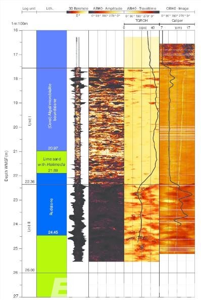
Applications of Borehole Imaging in the Oil and Gas Industry
This chart provides a clear overview of how borehole imaging is applied in various aspects of the oil and gas industry, highlighting its importance in improving exploration, drilling, and production activities.
| Application | Description | Benefits |
| Formation Evaluation | Assessing geological formations encountered during drilling. | Identifies hydrocarbon zones, and guides well placement. |
| Fracture Analysis | Detecting and analyzing fractures in borehole walls. | Determines reservoir permeability, and aids hydraulic fracturing design. |
| Wellbore Stability | Monitoring and assessing wellbore stability. | Identifies zones at risk of collapse, and informs drilling fluid selection. |
| Lithology Differentiation | Differentiating between various rock types based on imaging data. | Helps in identifying productive and non-productive zones. |
| Porosity and Permeability | Assessing porosity and permeability of rock formations. | Guides reservoir management and production strategies. |
| Fluid Characterization | Identifying and quantifying fluids within rock pores. | Assists in evaluating hydrocarbon potential and recovery methods. |
| Real-Time Decision Making | Using real-time imaging data to inform drilling and completion decisions. | Increases accuracy of well placement, and reduces operational risks. |
| Reservoir Monitoring | Monitoring changes in the reservoir over time. | Informs enhanced recovery techniques, and maximizes resource extraction. |
How Simulations are Used in Borehole Imaging
1. Tool Design and Optimization
Virtual Prototyping: Before physical manufacturing, borehole imaging tools are designed and tested in virtual environments. Simulations allow engineers to evaluate different design parameters, such as sensor placement, resolution capabilities, and operational limits, to optimize the tool's performance.
Performance Testing: Simulations are used to test how imaging tools will perform under various downhole conditions, including different temperatures, pressures, and fluid types. This helps in identifying potential issues and making necessary adjustments to the tool design to ensure reliability and accuracy in real-world applications.
2. Data Acquisition and Processing
Synthetic Data Generation: Simulations can generate synthetic borehole imaging data based on known geological models. This synthetic data is used to test and calibrate imaging tools and data processing algorithms, ensuring they can accurately capture and interpret real-world data.
Algorithm Development: Advanced data processing algorithms, including those using machine learning and artificial intelligence, are developed and refined using simulated datasets. This approach allows for thorough testing and optimization before deployment in actual borehole imaging operations.
3. Formation Evaluation and Reservoir Characterization
Geological Modeling: Simulations create detailed geological models of the subsurface based on borehole imaging data and other geophysical information. These models help geoscientists visualize and understand complex geological formations, such as fault zones, fractures, and sedimentary layers.
Fracture Simulation: Simulations of fractures and their propagation in the subsurface can be integrated with borehole imaging data to predict how fractures will affect reservoir permeability and hydrocarbon flow. This is crucial for designing effective hydraulic fracturing treatments and optimizing production.
4. Operational Planning and Risk Mitigation
Drilling Simulation: Simulating the drilling process, including borehole imaging operations, helps in planning the optimal drilling path and identifying potential hazards. By understanding how the borehole imaging tools will behave during drilling, engineers can adjust their strategies to minimize risks and ensure successful data acquisition.
Wellbore Stability Analysis: Simulations are used to assess wellbore stability by modeling the mechanical behavior of the rock formations surrounding the borehole. This helps in predicting potential wellbore collapse or instability issues and allows for the implementation of appropriate mitigation measures.
5. Integration with Other Subsurface Data
Multi-Physics Simulations: Integrating borehole imaging simulations with other subsurface data, such as seismic surveys, petrophysical logs, and core samples, creates a comprehensive understanding of the reservoir. Multi-physics simulations combine different types of data to provide a more accurate and detailed picture of the subsurface environment.
Reservoir Simulation: Borehole imaging data, when integrated with reservoir simulation models, helps in predicting fluid flow, reservoir performance, and the effectiveness of different production strategies. This aids in optimizing reservoir management and maximizing hydrocarbon recovery.
6. Future Prospects
- Advanced Real-Time Simulations: The future of borehole imaging simulations includes more sophisticated real-time simulation capabilities. These will enable continuous monitoring and adjustment of borehole imaging operations, leading to more adaptive and efficient exploration and production activities.
- AI-Enhanced Simulations: The integration of artificial intelligence with borehole imaging simulations will enhance predictive capabilities, allowing for more accurate forecasting of subsurface conditions and better decision-making in real-time.
- Virtual Reality (VR) and Augmented Reality (AR): The use of VR and AR in simulations will provide more immersive and interactive training environments and data visualization tools, improving the understanding and interpretation of complex borehole imaging data.
Conclusion
Borehole imaging stands out as a transformative technology that provides critical data that enhances exploration, drilling, and production activities. As technology continues to advance, borehole imaging will play an increasingly vital role in unlocking new hydrocarbon resources and optimizing the recovery of existing ones, contributing to the sustainability and efficiency of the oil and gas sector.